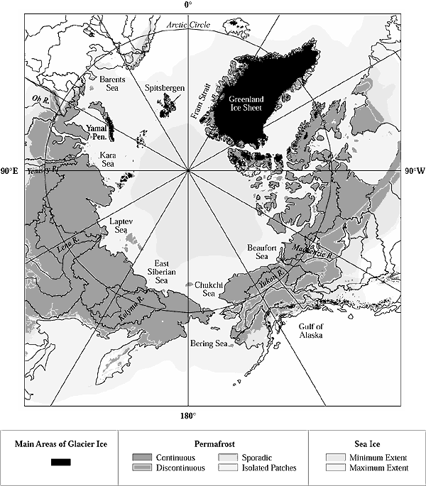
Figure 16-1: Location map
for the Arctic. Permafrost zonation, drainage basins, sea ice, and main areas
of glacier ice are shown. Drainage basins are delimited by solid black lines.
Permafrost zonation is based on a digital version of the map by Brown et al. (1997).